The free FATMAP alternative.

FATMAP closed on 1 October 2024. Traverse brings back what people loved about it: terrain you can read, the slope of every face, and maps that work offline. Free.

Get Traverse free
/ What you get

Everything for the next line, on one map.

Built for hiking, ski touring and mountaineering, with a safety layer FATMAP never had.

Terrain you can read

Real elevation in 3D at true scale, relief shading and contours. Enhanced relief only if you turn it on.

Slope angle layer

Every face coloured from 27° to above 45°, the band where most slab avalanches start. It describes terrain, not today’s danger.

Offline maps

Save the area and your route before you lose signal.

Record and plan

Record outings with GPS even without signal, import GPX, and see distance, ascent and an estimated time for any route.

Trip plans with SOS

Leave a plan before you go. If you do not check in, Traverse alerts your emergency contact step by step, and tells you exactly what it did.

Free

No subscription and no ads. We do not sell your data.

/ Try it

The slope layer, on real terrain.

Gjeravica in the Accursed Mountains. Toggle the layer and move over the map to read elevation and slope.
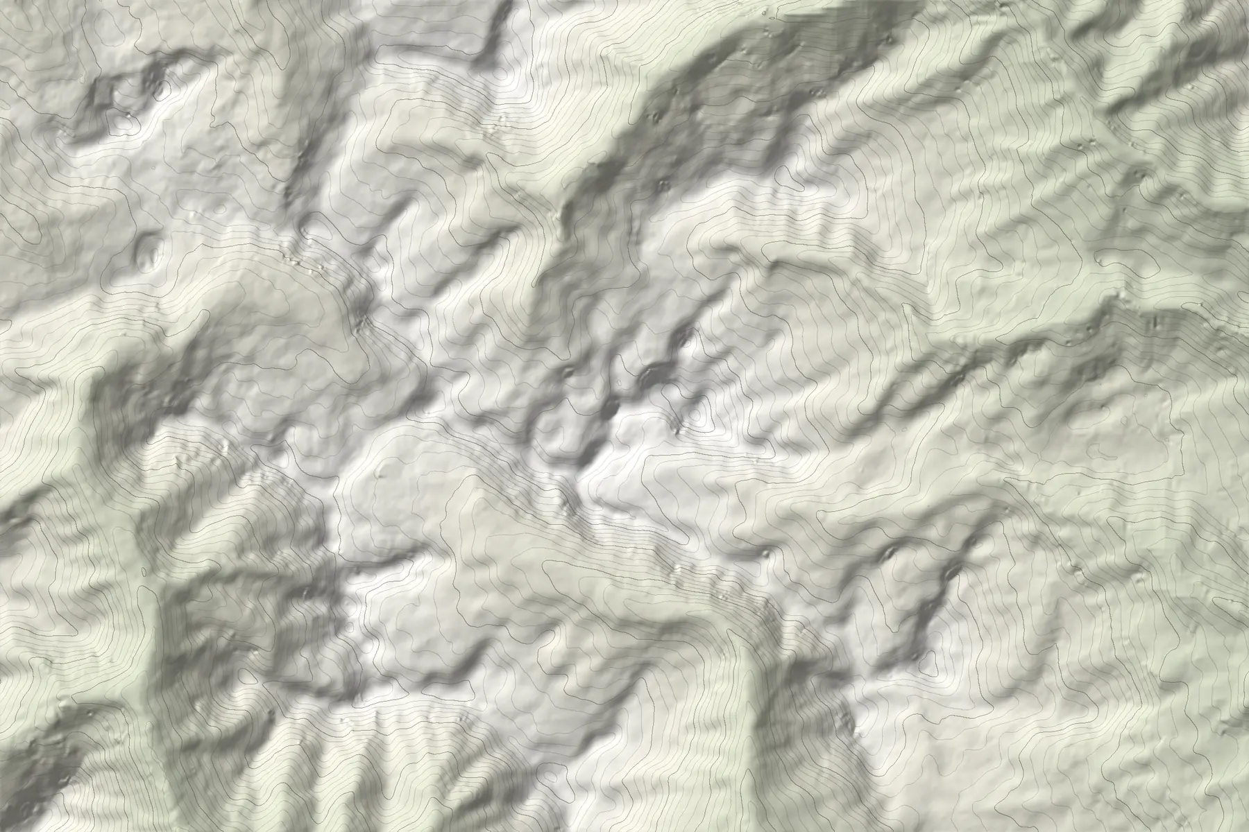
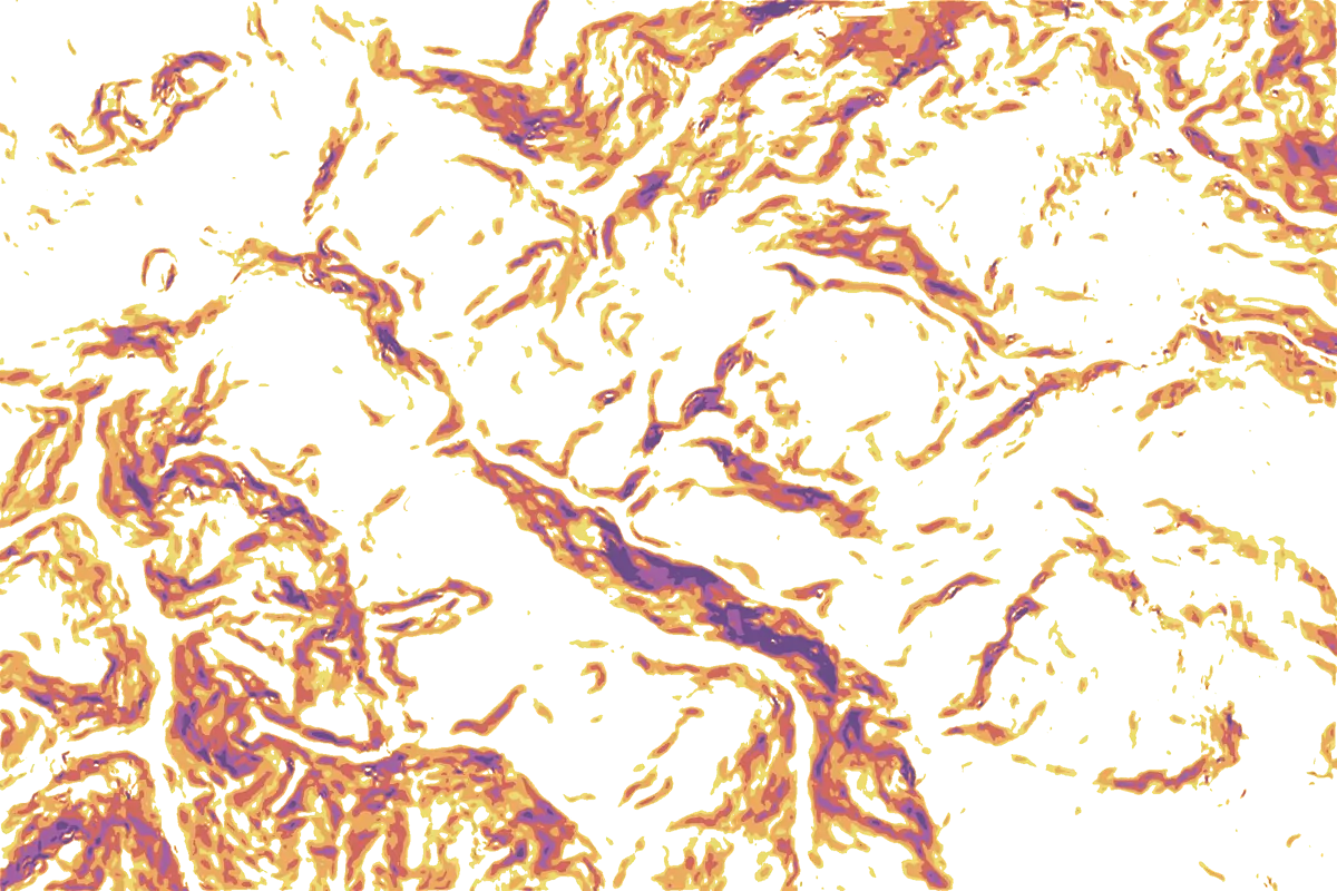
GjeravicaMove over the map
27°30°35°40°45°+Terrain, not today’s avalanche danger.Elevation: Terrain Tiles (EU-DEM, SRTM), smoothed, so small cliffs and gullies are softer than in reality. Contours every 50 m.

Read more in the slope angle map guide.

/ Questions
What happened to FATMAP?
Strava bought FATMAP in January 2023 and shut it down on 1 October 2024. Users could move their routes to Strava or download their data; some FATMAP content, such as guidebooks, grades and photos, was not carried over.
Is Traverse really free?
Yes. The map, the slope layer, recording, offline maps and trip plans are free, with no ads.
Can I bring my FATMAP routes?
If you downloaded your FATMAP data or moved routes to another app, export them as GPX and import them into Traverse.
Where does the slope layer work?
The slope layer and points of interest are live in the Western Balkans today (Kosovo, Albania and the Sharr mountains). Europe is next, then the rest of the world.
Does the slope layer tell me if a slope is going to avalanche?
No. It shows how steep the ground is. Avalanche danger depends on snowpack and weather on the day, so always check local conditions and forecasts.