Peaks of the Balkans

A 192 km loop through the Accursed Mountains, crossing between Albania, Kosovo and Montenegro on old shepherd paths, with nights in village guesthouses and summer huts.

Length
192 km loop
Countries
Albania, Kosovo, Montenegro
Stages
Usually 10, in 9 to 12 days
Season
Mid-June to September
/ Terrain
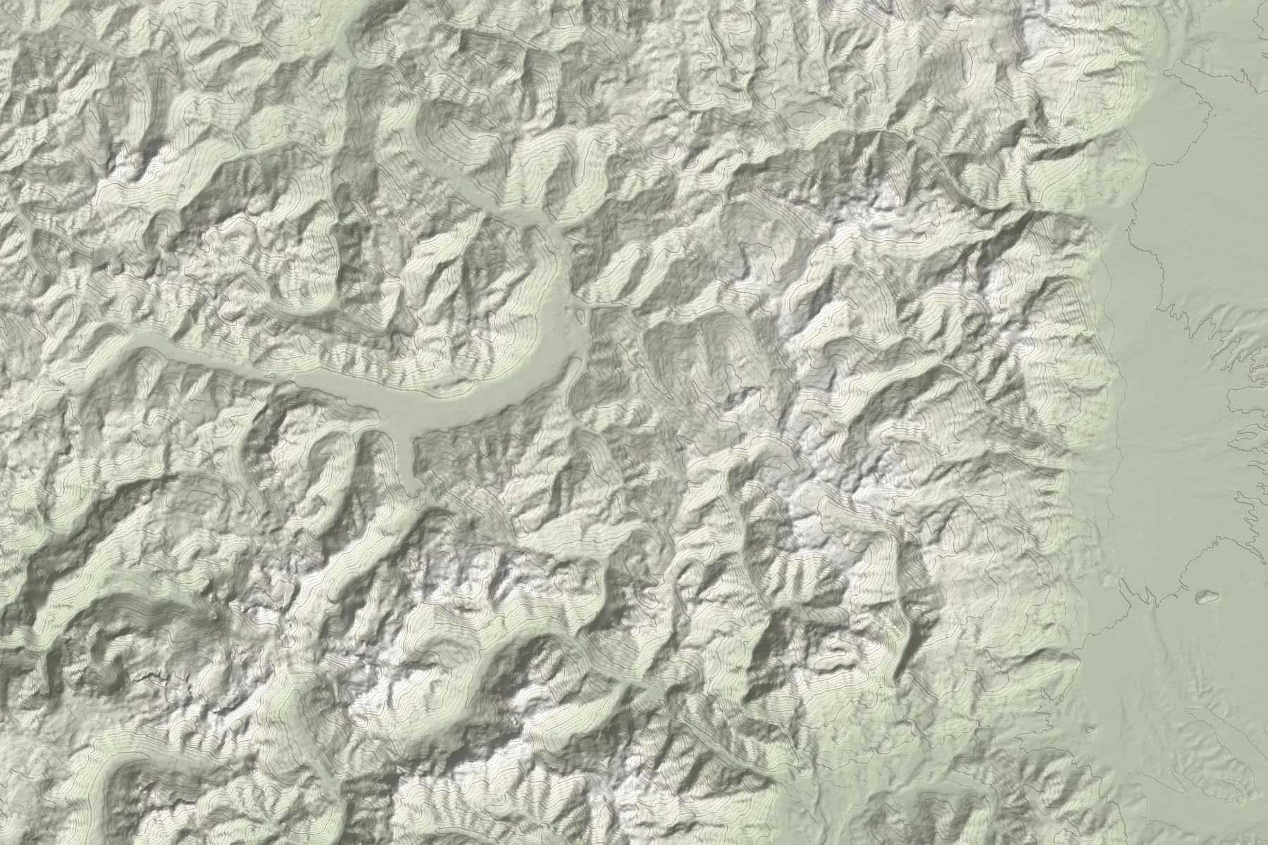
Maja JezercëThethValbonëVusanjePlavGjeravicaMove over the map
Elevation: Terrain Tiles (EU-DEM, SRTM) at about 28 m, smoothed, so cliffs and passes are softer than in reality. Contours every 100 m. The trail line is not drawn here; labels mark trail villages and summits.

Overview

The Peaks of the Balkans opened in 2012 as a cross-border trail through the Accursed Mountains (Bjeshkët e Nemuna in Albanian, Prokletije in Montenegro). It links valleys and villages that were long separated by closed borders.

Most hikers walk it anticlockwise from Theth, over to Valbonë, then east into Kosovo and back through Montenegro. Days are typically 6 to 8 hours of walking, and guidebooks put the high crossings at roughly 2,250 to 2,300 m. Sources differ on stage lengths, so treat any single number as approximate and check each day on the map.

The 10 classic stages

The usual anticlockwise loop. Many people start elsewhere, for example in Plav or near Peja, and some skip or join stages by road.

  • Theth to Valbonë, over the Valbona pass (about 1,800 m)
  • Valbonë to Çerem
  • Çerem to Dobërdol
  • Dobërdol to Milishevc, crossing into Kosovo near Gjeravica
  • Milishevc to Reka e Allagës
  • Reka e Allagës to Drelaj, in the Rugova valley
  • Drelaj to Babino Polje, into Montenegro
  • Babino Polje to Plav
  • Plav to Vusanje
  • Vusanje to Theth, back into Albania over Qafa e Pejës

Border-crossing permits

The trail crosses borders away from official checkpoints, so each crossing needs prior approval from the border police of the country you are leaving. Apply before the trip: at the time of writing, sources advise at least 15 days ahead for Albania and at least 10 days for Kosovo, and Montenegro charges a small administration fee. Rules and forms change, so follow the official cross-border page linked below and carry your passport and approvals.

Where to sleep and eat

Most stages end at family guesthouses or seasonal huts that offer dinner and breakfast, and many will pack a lunch. Several of the high settlements are only occupied in summer, so book ahead, especially in August. Water sources exist on most days but some dry up in late summer.

Check conditions before you go
Weather in the Accursed Mountains changes quickly and afternoon thunderstorms are common in summer. Snow can linger on the high passes into June. Official travel advice for Kosovo still warns that landmines and unexploded ordnance may remain in isolated forested and mountain areas near the borders. Stay on marked trails and established paths, and do not go alone. If you can call, call 112. Traverse describes terrain, not today’s danger.

Questions

How long is the Peaks of the Balkans trail?
About 192 km as a loop, usually walked in 10 stages over 9 to 12 days. Stage lengths differ between sources.
Do I need a permit for the Peaks of the Balkans?
Yes, for each border crossing. You apply in advance to the border police of the country you are leaving. Sources advise at least 15 days ahead for Albania and 10 for Kosovo; check the official cross-border page for current forms and fees.
When is the best time to hike the Peaks of the Balkans?
Mid-June to September. Snow can remain on high passes into June, and many guesthouses in the high settlements open only in summer.
Which direction is best?
Most hikers go anticlockwise from Theth to Valbonë, then into Kosovo and Montenegro. The loop can be started anywhere, for example in Plav, Vusanje or near Peja.
Can I hike it without a guide?
Many people do, with permits arranged in advance and the route on an offline map. Waymarking is patchy in places and signal is missing on parts of the high ground, so plan each day and leave a trip plan.